Link Track Wildlife Corridor
Clearfell logging threatened to cause habitat fragmentation of the Carlisle State Park.
The former Carlisle State Park located on the north-western slopes of the Otways was 5600 hectares in size but has now been incorporated into the Great Otways National Park.
The map below shows where Forestry Victoria had planned to turn Link Track into a log truck highway. Planned logging would have resulted in the total habitat fragmentation of the Carlisle State Park.
The Link Track wildlife corridor joins (or links) the southern end of Carlisle State Park to the north-eastern end of the Arkins Creek catchment with a strip of forested public land. The Link Track wildlife corridor varies from two kilometres at its widest to one kilometre on the Carlisle River.
To the east of the Link Track wildlife corridor is a pine plantation and to the west, cleared agricultural land.
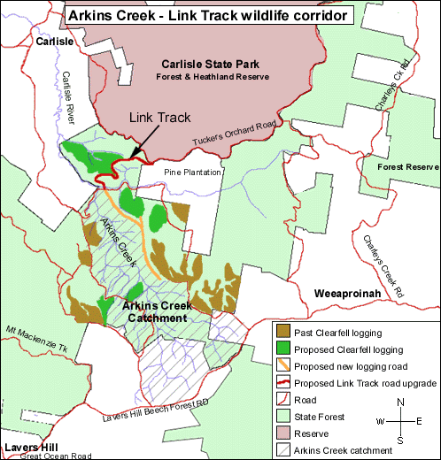
Map: Arkins Creek - Link Track Corridor. There are two corridors of State
Forest that connect to Carlisle State Park. One of these (to the East)
has been heavily clearfell logged in the past. The remaining corridor
of forest is scheduled for logging. If this forest is logged, an important
wildlife corridor will be lost. For logging to happen, Link Track would
need to be upgraded, and a new road bulldozed into the Arkins Creek Catchment,
affecting Warrnambool's water catchment.
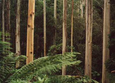
Forest at Link Track
Other links
If the Link Track Road is built, logging will proceed in Arkins
Creeks.
See a summary of issues regarding both Link
Track and nearby Arkins Creek.
See more information about Habitat Fragmentation.
See more information about Natural Landscapes.
See more information about Hollow Bearing Trees.
Don't know the meaning of a word? Check the glossary.