|
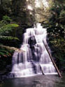
The Gellibrand Catchment.
The Western Victorian Dairy industry gets most of its domestic water
supply from the Gellibrand catchment. (Total catchment area 66,570 ha
,see table 1).
56% of the Gellibrand catchment is public land for which 18% is in legislated
reserves and 38% is available for logging now or in the future (State
Forest).
About 70% of the total Gellibrand catchment is still native forest with
17% cleared land (mostly located along river flats) and 13% softwood plantations.
Rainfall and vegetation types vary in the Gellibrand from high rainfall
wet forests to lower rainfall heath-land. The majority of summer water
runoff comes from the high rainfall forested components of the catchment.
Table 1: Land use in the Gellibrand catchment (Hectares)
|
|
|
|
|
|
|
|
Catchment
|
Total
|
Public Land
|
|
|
|
(ha)
|
Forest
|
Reserves
|
Total Public
|
|
|
Upper Gellibrand
|
49,870
|
17,160
|
8,900
|
26,060
|
|
|
|
34%
|
18%
|
52.3%
|
|
|
|
|
|
|
|
|
|
South Gellibrand
|
16,700
|
7,810
|
3,110
|
10,920
|
|
|
|
47%
|
19%
|
65.4%
|
|
|
|
|
|
|
|
|
|
Total Gellibrand
|
66,570
|
24,970
|
12,010
|
36,980
|
|
|
|
38%
|
18%
|
56%
|
|
| |
|
|
|
|
|
|
|
|
|
|
|
|
|
Catchment
|
|
Private Land (Incl Water oards)
|
|
|
|
Forest
|
Pines
|
ex VPC Pine
|
Cleared
|
Total Private
|
|
Upper Gellibrand
|
7,480
|
6,600
|
890
|
8,840
|
23,810
|
|
15%
|
13%
|
2%
|
18%
|
48%
|
|
|
|
|
|
|
|
|
South Gellibrand
|
2,000
|
1,060
|
-
|
2,720
|
5,780
|
|
12%
|
6%
|
0%
|
16%
|
35%
|
|
|
|
|
|
|
|
|
Total Gellibrand
|
9,480
|
7,660
|
890
|
11,560
|
29,590
|
|
14%
|
12%
|
1%
|
17%
|
44%
|
|
|
|
|
|
|
|
|
Catchment
|
Total
Native
|
Total
Pine
|
Total
Cleared
|
|
|
|
Upper Gellibrand
|
33,540
|
7,490
|
8,840
|
|
|
|
67%
|
15%
|
18%
|
|
|
|
|
|
|
|
|
|
|
South Gellibrand
|
12,920
|
1,060
|
2,720
|
|
|
|
77%
|
6%
|
16%
|
|
|
|
|
|
|
|
|
|
|
Total Gellibrand
|
46,460
|
8,550
|
11,560
|
|
|
|
70%
|
13%
|
17%
|
|
|
|
Note: Based on data from Otway Forest Management Plan 1992.
|
|
A small amount of private forested land has since been bought
back by the State Government.
|
|