Incorrect OFMP map
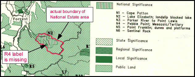
Below is the map from the Otway Forest Management Plan that shows the Lake Elizabeth National Estate area. The boundary shown in the map is incorrect. OREN has shown the correct boundary in red to highlight this. The map is also missing the R4 label on the small green patch, which represents the Barwon River East Branch landslip (R4).
See the correct map in the West RFA.
back to Lake Elizabeth National Estate.
back to Lake Elizabeth National Estate.
Don't know the meaning of a word? Check the glossary.